[ad_1]
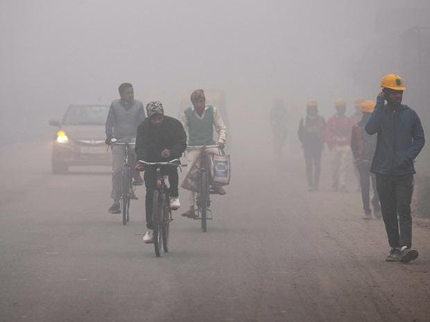
According to the current IMD forecasts, coldwave to severe coldwave conditions will continue to prevail over the Indo-Gangetic plains. The pleasant chill of December has turned into a severe cold wave with dense fog in parts of Punjab, Haryana, Chandigarh, Delhi, and Uttar Pradesh.
The IMD had issued a long-range monthly forecast that the temperatures will likely remain below normal over many parts of northwest India throughout January 2023.
In its January 5 forecast, the IMD predicted that “cold wave to severe cold wave conditions” will prevail in isolated pockets of northern parts of Rajasthan and cold wave conditions in isolated pockets over Punjab, Himachal Pradesh, and Haryana, Chandigarh and Delhi during next 24 hours.
The cold wave conditions will likely continue over northwest India during the next two days, and the intensity will decrease after that. The dense fog has reduced visibility all over North India and disrupted air and rail traffic.
“Light winds and high moisture near the surface over Indo-Gangetic plains, dense to very dense fog very likely to continue in some/many pockets during night/morning hours over Punjab, Haryana, Chandigarh and Delhi and Uttar Pradesh in next two days and dense fog thereafter; in isolated pockets over Uttarakhand and Rajasthan during next two days.” the IMD said in its All India weather summary and forecast bulletin.
On Thursday, Delhi recorded the minimum temperature at 2.8 degrees Celsius at Lodi Road. The IMD has said that the minimum temperature will likely stay consistently below 4 degrees Celcius till Saturday, December 7, in Delhi.
However, today on January 6, a red warning prevails in Punjab’s Moga district, while a red alert continues over most of North India.
What is a cold wave?
According to IMD, when the minimum temperature dips below 10 degrees Celcius in the plains, the subsequent maximum temperature drops at least 4.5 degrees Celsius below normal. And a severe cold wave is declared when the minimum temperature dips to 2 degrees Celsius or the departure from normal is more than 6.4 degrees Celcius.
Due to these conditions, the IMD issued a red warning (meaning ‘take action’) over these regions on Wednesday and Thursday. The “red alert” has replaced the “red warning” today, January 6.
What is the difference between a red alert and a red warning?
The IMD has four categories to depict weather conditions on India’s map. It uses red, orange, yellow, and green to show these climate conditions.
-
The red colour depicts a “red warning” and tells authorities to take action. -
The orange colour depicts a “red alert” and signals the authorities to stay alert. This condition is less severe than a red-warning condition. -
The yellow colour asks the authorities to monitor. It is better than the red alert. -
The green colour signals a no-warning zone.
[ad_2]
Source link


